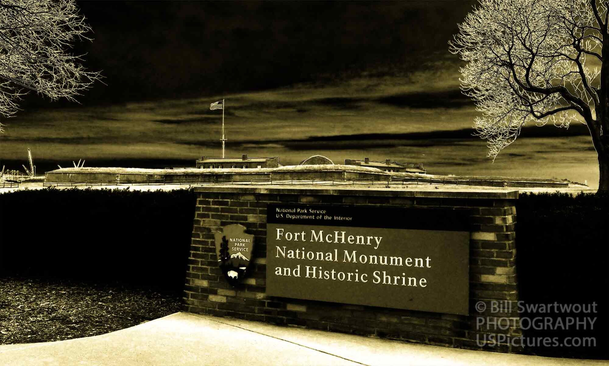
The perfect location to construct a fort to defend the city of Baltimore.
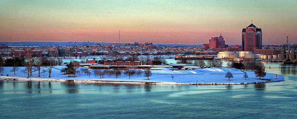
The location of Fort McHenry was not decided by chance, it was decided by geography. Any fleet of warships attempting to reach Baltimore had to sail up the Chesapeake Bay and the Patapsco River. The river splits into two parts with the northern branch leading directly to the city itself and the southern branch leading to a possible “back door” approach to the city. The easternmost end of the Baltimore Peninsula was the best natural location to build the defensive fort, Fort McHenry, to protect the city.
When the War of 1812 began, the city of Baltimore was a major point of contention between the British and Americans. The British Navy blockaded Baltimore Harbor in an attempt to cut off American trade and prevent their ships from resupplying the American troops. In response, the Americans built Fort McHenry on the Baltimore Peninsula to defend the city from attack.
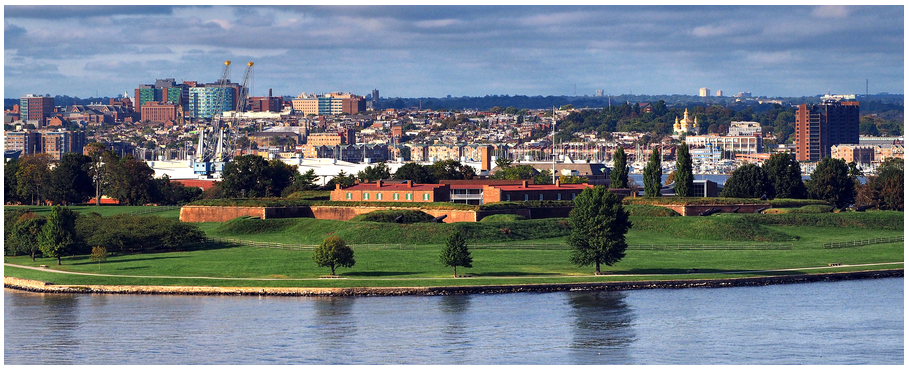
Fort McHenry was an ideal location for the defense of this important maritime port city. The Baltimore Peninsula is a long, narrow strip of land that juts out into the Chesapeake Bay. It was the perfect location to build Fort McHenry, because it provided a clear view of the bay and the ships that were approaching Baltimore. The fort was also close enough to the city to provide protection, but far enough away so that the city could not be bombarded by the enemy. The peninsula on which Fort McHenry was built was the perfect location for the defense of Baltimore. The peninsula is surrounded by water on three sides, with only a narrow strip of land connecting it to the mainland. This made it an ideal spot to build a fortification protecting the city from attack.
Shopping link to: Fort McHenry Gallery.
Interesting story, nicely put together. I’m learning more with each article!
Thanks, Steve. I’ll try to come up with a few more.
The only thing missing from this historical introduction is a map for people who don’t know the area as well as y’all locals do. If you can find a scan of a map from the early 1800s, that would be just cherry.
Thank you, Katrina – that is a great idea. I’ll have to check the National Archives, Smithsonian and/or Library of Congress.
Love the history lesson and the imagery. Nice work Bill!
Thanks, Bob. We used to live within walking distance of the Fort and it remains on e of my favorite places to visit when we are back on the Baltimore peninsula known as South Baltimore.
Wonderful panoramic images and colors at the blue hour!
Thanks, Tatiana. That “blue hour” image was shot form the deck of a cruise ship departing the southern side of the Baltimore peninsula at Port Covington late in the afternoon.